Why Some Children Become Fascinated With Maps, Routes, and Where Things Are
July 23, 2026
0
Some children want to know exactly where every road goes. They remember which turn comes after the bridge, ask why the family used a different route, study transit
Some children want to know exactly where every road goes. They remember which turn comes after the bridge, ask why the family used a different route, study transit maps, draw floor plans, and notice when a familiar building appears in the wrong place on a picture.
A child may spend long periods tracing roads with a finger, arranging toy vehicles into routes, or explaining how to travel from home to school. Even a short trip can lead to detailed questions: Which direction are we facing? What is behind that building? Does this road connect to the highway? How far away is another city?
Adults may view this interest as a preference for cars, travel, or geography. In many cases, it reflects something broader. Maps allow children to turn large, complicated spaces into visible patterns. Routes create order, landmarks support memory, and symbols show how places relate without requiring the child to visit all of them at once.
An interest in maps can support spatial thinking, planning, observation, storytelling, and growing independence. Parents can encourage it without turning every trip into a lesson or expecting the child’s maps to be perfectly accurate.
Maps make invisible relationships visible
Children experience places one moment at a time. They walk through a hallway, ride along one road, enter one shop, and later return home. A map shows how those separate experiences fit together.
The child can see that the park is behind the library, the school is north of home, and two roads that feel unrelated eventually meet. This can be exciting because it reveals a structure that is difficult to notice from ground level.
Maps also allow children to think about places that are not currently visible. A bedroom, neighborhood, city, or country can be represented on one page. The child begins connecting real space with a smaller symbolic version.
Routes create a predictable sequence
A familiar route contains an order: leave home, pass the corner shop, cross the main road, see the playground, and arrive at school. Children may enjoy knowing what comes next.
This sequence can make travel feel manageable. The child can track progress through visible landmarks rather than experiencing the trip as an unknown length of time.
A route also provides a beginning, middle, and end. It works almost like a story. Each turn moves the family closer to a destination, and each landmark confirms that the trip is following the expected path.
Landmarks help children organize memory
Young children do not always remember distances or street names accurately, but they often remember striking objects. A red door, tall tree, mural, tunnel, fountain, or unusual sign may become an important location marker.
These landmarks divide a journey into meaningful sections. The child may not know that the destination is two miles away, but may know it comes after the roundabout and before the large grocery store.
Parents can support this skill by asking, “What do you notice just before we turn?” or “Which landmark tells you we are almost there?”
The goal is not to test the child. It is to help the child notice how memory and place work together.
Children may enjoy the logic of symbols
Maps use simple marks to represent complicated things. A line can become a road, a blue shape can represent water, and a small square can stand for a building.
Children often find this symbolic system satisfying. Once they understand a key or legend, they can decode information that is not written in full sentences.
This is different from ordinary picture viewing. The child must understand that the image is not trying to look exactly like the real place. It is selecting certain information and leaving other details out.
That realization can support broader symbolic thinking used in diagrams, graphs, schedules, and other forms of visual information.
Maps offer a sense of ownership over movement
Children are often passengers. Adults decide where to go, when to leave, which road to take, and when the trip is complete.
Understanding a route gives the child a greater sense of participation. The child may announce the next turn, identify the destination, or explain how two places connect.
This does not mean the child controls the journey. It means the child can follow the plan instead of being moved through it without understanding.
For some children, that knowledge makes travel feel less passive and more secure.
Credit:RDNE Stock project / Pexels | alt text: A young child holding a map
Drawing maps develops more than geography knowledge
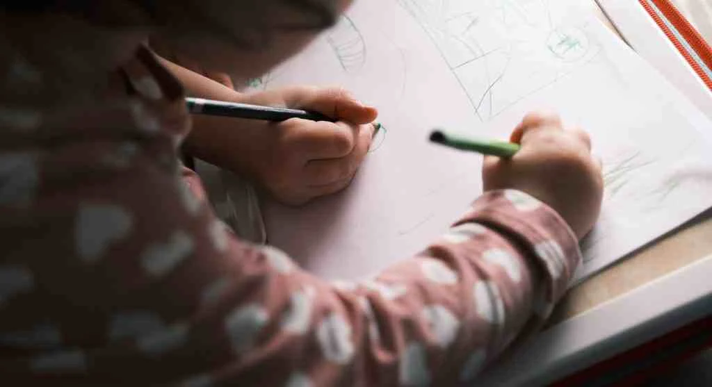
When children draw maps, they must decide what matters. A map of a bedroom may include the bed, door, window, toy shelf, and rug while leaving out smaller objects.
This requires selection, positioning, scale, and perspective. The child is deciding how to show a three-dimensional place on a flat page.
Early maps may place objects in unusual positions or make favorite locations much larger than everything else. These are not necessarily mistakes that need immediate correction. They reveal what the child notices and how the space is understood.
Personal maps often begin with meaningful places
Children may be more interested in mapping familiar spaces than distant countries. A bedroom, school route, playground, grandparent’s home, or favorite shop has emotional importance.
A map of these places combines memory with identity. The child is not only showing where objects are located but also which places matter.
Parents can invite mapping through simple prompts:
Draw the route from your bedroom to the kitchen.
Make a map of the playground.
Show where everyone sits during dinner.
Draw the places we visit on a normal Saturday.
The activity should remain open enough for the child to choose what to include.
Treasure maps turn spatial thinking into play
A simple treasure map gives children a reason to use symbols, directions, landmarks, and sequence. The treasure can be a note, sticker, book, snack, or small household object.
One person hides the item and draws the route. The other follows it. Then the roles switch.
Children quickly discover that a map must contain enough information for someone else to understand it. They may add arrows, count steps, draw furniture, or create a key.
This introduces an important idea: a useful map is not only meaningful to the person who made it. It must communicate with another person.
Transit maps can appeal to children who enjoy systems
Bus, train, and subway maps show more than physical distance. They also show networks, transfers, stops, and different possible paths.
A child may enjoy discovering that two destinations can be reached through more than one route or that changing lines creates a new connection.
Parents can use a transit map to discuss practical questions. Where would the family board? Which stop comes before the destination? Where would a transfer happen?
These conversations can stay simple. The child does not need to master the entire system to enjoy following one useful path.
Allow the child to lead familiar routes safely
On a well-known walking route, a child may be allowed to announce the next safe step while the adult remains responsible for supervision.
The child might say, “We turn after the mailbox,” or “The crossing is beside the shop.” This provides practice without placing safety decisions entirely on the child.
Adults should still manage traffic, boundaries, and unexpected changes. Route leadership is a learning activity, not a transfer of adult responsibility.
Use direction words in everyday conversation
Children often understand location through words such as beside, behind, across, near, between, above, and below before using compass directions.
Parents can describe locations naturally: “Your shoes are beneath the bench,” or “The pharmacy is across from the library.”
Older children may enjoy learning north, south, east, and west. A simple compass or phone compass can show how directions remain stable even when the child turns around.
There is no need to quiz constantly. Repeated exposure during real movement is usually more useful than isolated memorization.
Avoid correcting every inaccurate detail
A child may draw the school larger than the neighborhood, place two streets too close together, or reverse the direction of a turn.
Immediate correction can shift the activity from exploration to performance. Instead, parents can ask, “How did you decide where to put the park?” or “What would help someone know which way to turn?”
If accuracy matters for a real journey, compare the child’s map with an official one. The two versions can be discussed rather than treating one as a failure.
Compare different kinds of maps
A road map, weather map, park map, transit map, and floor plan each serve a different purpose. They emphasize different information.
Parents can ask what each map includes and leaves out. A park map may show trails and toilets but not every tree. A transit map may simplify distance to make connections easier to follow.
This teaches children that visual information is designed for a purpose. No single map shows everything.
Use mapmaking to support storytelling
Children who enjoy imaginary worlds can draw islands, cities, kingdoms, space stations, or underground tunnels. The map can become the setting for a story.
The child may decide where characters live, which areas are dangerous, how travelers move, and what lies beyond the known boundary.
This combines spatial thinking with cause and effect. A river may block travel, a mountain may hide a village, or two roads may lead to different outcomes.
Parents can ask story-based questions without taking over: “Who uses this bridge?” or “Why does the road stop here?”
Credit:Tess h. / Pexels | title: Fantasy Map Created by a Young Artist
Route changes can reveal how the child handles uncertainty
A child who knows a route well may object when an adult takes a shortcut, misses a turn, or chooses a different road. The reaction may come from surprise rather than stubbornness.
The expected sequence has changed, and the child may not yet understand how the new route reaches the same destination.
Parents can explain the change briefly: “The usual road is closed, so we are taking another route. Both roads reach the library.”
When possible, show the alternative path on a map. Seeing both routes can make the change easier to understand.
Do not promise that every trip will follow the expected route
Predictability can be helpful, but travel always includes occasional changes. Traffic, construction, weather, missed turns, and family needs may alter the plan.
Parents can prepare children by using flexible language: “We usually take this road,” rather than “We always go this way.”
The child can also learn a useful principle: the route may change while the destination stays the same.
Set safety boundaries around location knowledge
As children become interested in addresses, map apps, and route sharing, families should discuss which location details are private.
A child may know the home address for emergencies without posting it in a game, public profile, group chat, or video. School routes, live location, and regular family schedules should also be shared carefully.
Parents can explain that maps are useful because they show where people and places are. That same power means location information deserves protection.
Use digital maps with a clear purpose
Map apps can show traffic, satellite images, walking routes, terrain, and street views. These tools can deepen a child’s interest, but unstructured use may turn into endless searching.
A family can choose one question before opening the app: How far is the museum? Which route has fewer turns? What is near the campsite?
This keeps the technology connected to real planning and observation.
Children should also understand that digital routes can be wrong, outdated, or unsuitable. An adult remains responsible for checking safety and practical conditions.
Connect maps with family history
Maps can help children understand where relatives have lived, where family members traveled, or how a move changed daily life.
A parent might mark a grandparent’s hometown, trace a past road trip, or compare the distance between family members.
This can make family stories more concrete. The child sees that events happened in places with real relationships and distances.
The activity should remain respectful of private family information and avoid sharing precise personal locations publicly.
When a strong map interest may need closer attention
A deep interest in maps and routes is often positive. It may support learning, confidence, and play. Families may want additional guidance when the child becomes extremely distressed by minor route changes, cannot participate in necessary activities without reviewing every path, or repeatedly attempts to leave safe boundaries to test a route.
Closer attention may also help when location questions are driven by intense fear, such as constant worry about getting lost despite appropriate support.
A teacher, pediatric professional, or qualified child specialist can help families consider the broader pattern. The interest itself is not a problem; the concern is whether distress or unsafe behavior is interfering with daily life.
How map interests can grow over time
A young child may begin by recognizing the route to school. Later, the same interest may expand into geography, transportation, architecture, urban planning, hiking, history, weather, travel, or digital design.
The child may move from drawing one room to understanding scale, coordinates, elevation, and networks. No particular outcome needs to be predicted.
Parents can support the interest by keeping it connected to real experiences, creative play, and age-appropriate independence.
A map-loving child is often doing more than memorizing roads. The child is learning how the world fits together.
Frequently Asked Questions
Q: Why are some children fascinated with maps?
A: Maps help children understand how places connect, organize memories, follow predictable sequences, decode symbols, and gain a greater sense of participation in travel.
Q: Is drawing inaccurate maps still useful?
A: Yes. Early maps show what the child notices and how space is understood. Accuracy can be introduced gradually through comparison and real-world observation.
Q: What map activities work well at home?
A: Children can draw bedroom maps, create treasure hunts, trace familiar routes, compare transit maps, design imaginary worlds, or map a family outing.
Q: How can parents help when a child dislikes route changes?
A: Explain why the route changed, show the alternative on a map when possible, and remind the child that different paths can lead to the same destination.
Q: When should a strong route interest receive extra support?
A: Support may help when route changes cause severe distress, the interest leads to unsafe wandering, or location worries interfere with school, travel, or family routines.
Key Takeaway
Children fascinated with maps are often exploring how places, symbols, routes, and memories fit together. Parents can support this interest through personal maps, treasure hunts, landmark conversations, transit planning, imaginary worlds, and safe route leadership. The aim is not to correct every detail or turn each journey into a test. It is to give the child useful ways to understand space while gradually building flexibility, safety awareness, and independence.